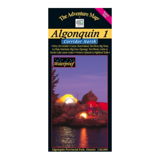
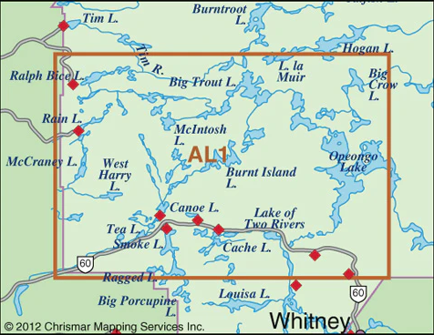
Our detailed topographic map & guide to all paddling routes, hiking & backpacking trails, and attractions all along and well north of the Highway 60 corridor in Algonquin Provincial Park, Ontario. It covers the area from Opeongo Lake and the Visitor Centre in the east, to the Park boundary in the west, and from the Tim River and Lake La Muir in the north, to Ragged Lake and Whitefish Lake in the south.
In addition to extraordinary terrain and vegetation detail, this map features campsite, portages, access points, hiking & backpacking trails, facilities like parking, campgrounds, telephones, historic sites and other attractions.
Scale: 1:60,000. Waterproof.
For more information visit www.chrismar.com